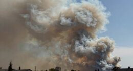

The National Weather Service (NWS) predicts severe storms and tornadoes using advanced techniques like Doppler radar, satellite imagery, and real-time observations. Radar detects storm rotation and wind patterns, while storm chasers provide expert on-the-ground insights. Combining these technologies helps the NWS quickly identify signs of tornado development and issue warnings. If you want to understand how these tools work together to keep you safe, you’ll find more details ahead.
Key Takeaways
- The NWS combines Doppler radar data, satellite imagery, and storm reports to forecast tornado development accurately.
- Doppler radar detects storm rotation and velocity patterns indicating potential tornado formation.
- Storm chasers provide real-time observations that validate and enhance radar-based predictions.
- Rapid analysis of storm structure and velocity patterns allows the NWS to issue timely tornado warnings.
- Continuous technological advances and human observations improve the reliability and effectiveness of tornado prediction.
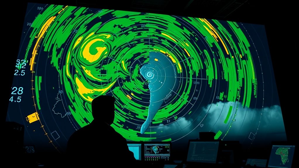
Tornado warnings are a essential part of weather safety, alerting you to imminent danger and giving you precious time to seek shelter. These warnings rely heavily on advanced technology and keen observations to predict when a tornado might develop. One of the most critical tools used by meteorologists is Doppler radar, which allows them to detect severe weather patterns in real-time. Unlike traditional radar, Doppler radar can measure the velocity of raindrops and hailstones within a storm, revealing wind rotation and patterns indicative of tornado formation. When a storm shows signs of rotation or other dangerous features, meteorologists issue tornado warnings to keep the public informed and safe.
Storm chasers also play a vital role in the science of tornado prediction. These dedicated individuals follow severe storms across tornado alley, gathering firsthand observations that complement radar data. Their on-the-ground insights often help confirm radar indications of a tornado’s formation or strength, especially in situations where technology may have limitations. Storm chasers can spot subtle signs of rotation, wall clouds, or other features that might escape detection from afar, providing valuable confirmation for emergency alerts. Their work helps refine forecasting models and improves the accuracy of warnings, making it possible for communities to respond more effectively.
The process of issuing a tornado warning involves a combination of Doppler radar data, satellite imagery, and reports from storm chasers or spotters. When Doppler radar detects rotation within a storm, meteorologists analyze the velocity patterns and storm structure to assess whether a tornado might be forming. If the data indicates a high likelihood of a tornado, warnings are issued promptly to alert residents, emergency services, and local authorities. This swift response is crucial, as tornadoes can develop rapidly, leaving little time for people to react if they aren’t warned in advance.
Thanks to the continuous improvement in radar technology and the dedicated efforts of storm chasers, tornado warnings are now more accurate and timely than ever before. This combination of high-tech data and human observation forms the backbone of the National Weather Service’s ability to predict and warn about tornado threats. As a result, communities have a better chance to seek shelter, protect their loved ones, and minimize damage. Understanding how Doppler radar and storm chasers work together highlights the science behind tornado warnings and underscores their importance in keeping you safe during severe weather events. Additionally, advancements in appliance maintenance technology and techniques help ensure safety and efficiency in many related fields, emphasizing the importance of continued innovation and expertise.
Doppler radar weather station
As an affiliate, we earn on qualifying purchases.
As an affiliate, we earn on qualifying purchases.
Frequently Asked Questions
How Accurate Are Tornado Predictions Compared to Other Severe Weather Forecasts?
You might wonder how tornado predictions compare to other severe weather forecasts. Historically, tornado forecast reliability varies, but improvements have boosted accuracy over time. While predictions for tornadoes may not be perfect, they are often more precise than earlier, less sophisticated forecasts. You can generally trust current technology and data, which enhance the reliability of tornado warnings, helping you stay safe even when the forecast isn’t 100% certain.
What New Technologies Are Being Developed to Improve Tornado Warning Times?
You’re curious about new technologies to improve tornado warning times. Radar innovations are advancing, providing more detailed and faster storm detection. Detection sensors are being deployed in remote areas to catch early signs of tornado formation. These developments help meteorologists identify severe weather sooner, giving you critical extra minutes to seek safety. With these improvements, tornado warnings become more accurate and timely, ultimately saving lives and reducing damage.
How Do Meteorologists Decide When to Issue a Tornado Warning?
Your life depends on how well meteorologists decide when to issue a tornado warning. They analyze storm tracking data, looking for signs that meet warning thresholds—like rotating clouds or hail. If these indicators become severe or imminent, they act swiftly. Their decision balances scientific data and public safety, aiming to give you enough time to seek shelter, even if it feels like a race against time itself.
Can Tornado Warnings Be Predicted Days in Advance?
You can’t predict tornado warnings days in advance because tornado climatology shows these events are highly localized and unpredictable over long periods. Meteorologists analyze weather patterns and risk factors, but warning communication relies on short-term forecasts, not long-term predictions. While climate trends help understand tornado seasonality, immediate warnings depend on real-time data, ensuring you get timely alerts only when a tornado is imminent or occurring.
How Do Weather Alerts Differ Between Regions With Varying Technology?
Weather alerts are like different languages, shaped by regional disparities and technological gaps. In tech-savvy regions, you get detailed, timely warnings through advanced systems and apps. Elsewhere, alerts might be slower or less precise due to limited technology. You need to stay vigilant and adapt, knowing that where technology’s lacking, alerts might not reach you as quickly, making it essential to have local emergency plans in place.
storm chaser weather camera
As an affiliate, we earn on qualifying purchases.
As an affiliate, we earn on qualifying purchases.
Conclusion
By understanding how the NWS predicts tornadoes, you can better appreciate their efforts to keep you safe. Did you know that tornado warnings have improved considerably over the past few decades, saving countless lives? Your awareness and quick response to these alerts make a real difference. Stay informed, heed warnings promptly, and remember that science continues to advance, making tornado predictions more accurate than ever. Together, we can stay safer during severe storms.
tornado warning alert system
As an affiliate, we earn on qualifying purchases.
As an affiliate, we earn on qualifying purchases.
severe weather detection device
As an affiliate, we earn on qualifying purchases.
As an affiliate, we earn on qualifying purchases.